After breakfast at Jerri and Mark’s, I went into downtown Asheville for some sightseeing. I wonder if it is a requirement that every medium-sized city must have a phallic symbol prominently displayed?
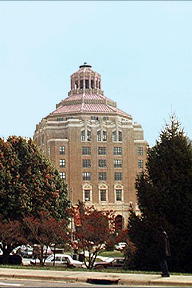 |
Asheville itself was very pretty, again especially with the leaves turning colors and all that. Of course, I grew up (grades 8-12) in a small apple town on the eastern side of the Cascade Mountains in Washington state, called Cashmere (home of the most fabulous candy in the world, Aplets & Cotlets), so I am able to fully appreciate the landscape around Asheville (although Cashmere is only a fraction of the size). | 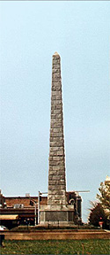 |
| Leaving Asheville, I attempted to head down the highway into South Carolina and to Greenville, but I got a little lost. I ended up taking the business route for Highway 25 — I think that’s what they call it when you go 35 miles an hour past banks and KFCs and Wal-Marts. I eventually got out of the suburban/rural mix and into the foothills again, where the fog started coming in very dense. After close to an hour driving these backroads, I finally found an on-ramp to the real highway and I was on my way. | 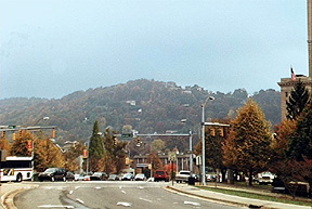 |
I’ve heard it said before that, no matter where you are in the country, you can always find a country station or a religious one. Now, I don’t know if that’s really true, but it certainly seemed that way driving through North Carolina, South Carolina, and Georgia. Of course, on the flip side of this, I was traveling on election day. Aiee! Political ad after political ad after political ad, and all of them for conservative candidates. I’m not going to pass judgment on Clinton (or Starr, or whomever) here, but jeez, give it a rest! I began to wonder whether the lack of non-conservative ads was because this was the South, because these were country music stations, or more likely, that the liberal candidates hoped to spend their final ad dollars where they wouldn’t be drowned out by Ditto Heads.
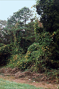 |
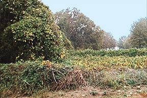
For years, I have heard about the menace of kudzu in the south — immortalized on the Shenandoah album “Under the Kudzu” . A vine imported from Japan, it has acquired a stranglehold on parts of the south, covering and something trees, buildings, telephone poles — you name it. I don’t think I ever really believed it was quite so serious until I got into South Carolina and Georgia and saw... whoa. One image that sticks in my mind was of a set of two or three trees completely engulfed in the stuff, plus a nearby telephone pole, with more of the vines draping several feet down from the wire halfway across the road in a big curtain. The couple of small pictures I took just don’t do the sight justice, I’m afraid. |
|
Once I crossed into Georgia, it was a straight shot into Atlanta. I did get promptly annoyed by the exit numbering system they use, though: each exit number increases or decreases by one from the preceding one (depending on the direction you are traveling). While this lets you know how many exits there are until the end of the highway you are on, if you think about it, you’ll agree that that piece of information is darn near useless. (How many people go all the way to the end of the highway? And why do you care that it’s 12 more exits to the end, if you don’t know how far apart the exits are? And what happens when they add a new exit? Do they have to make dozens of new signs? Ye, gods!) You see, I grew up in Washington and Oregon, where they have the sense to number their exits after the milepost (and if two exits at at the same milepost, they become 23A and 23B, or whatever). This permits you to not only tell someone to take Exit 17, but they can also tell just how far it is from the current exit. (But even the Georgia [and Florida] exit numbering beats California. Here they don’t number them at all. And when you get a street like Stevens Creek Boulevard in Silicon Valley running next to the freeway and crossing it several times, you get several exits with the same name! Makes it reeeaaaal easy to gives directions, let me tell you!)
But I digress...
One stop along the way was at a store called Boots, Etc. Understand that I am dangerous in western wear stores. I went into Sheplers in Austin looking for “maybe a shirt, if there’s one on clearance,’ and came out with one shirt and two pairs of boots. (The boots part is one of those cases of “buy ’em when you find ’em’: I have very small, hard to fit feet — Men’s Size 6-1/2 (!) — so I end up buying my boots from the women’s section, and even there can rarely find boots I can wear.) So when I saw the big billboards advertising Boots, Etc., I knew I was in trouble. I escaped with only one new shirt (from Cumberland Outfitters) and a waist-length Australian duster.
Once I finally made it to Atlanta, then there was the process of finding the bed and breakfast I was staying at, Midtown Manor. As I mentioned above, the map I had took me to the capitol building. After driving around in the area I thought was correct, I stopped to buy a map. Wouldn’t you know it, but the station had no maps. So off and driving some more. I apparently managed to find one of the gay neighborhoods of Atlanta, because there were three houses on one block flying rainbow flags. I finally found a gas station with maps, bought one, and shortly found my way to where I was staying that evening.
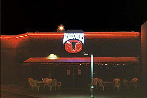
| After settling in, I drove around to check out where different places were. Found the Atlanta Eagle no problem, and then the local queer bookstore. Ate dinner across the street from it a trendy Japanese-style restaurant, had coffee at Caribou Coffee (which I was surprised to see, since I had only known them in Chicago before), and then ventured off to find Hoedowns, the local gay country-western bar. (The last time I was in Atlanta was 1995, when Hoedowns was still on Cheshire Bridge; it’s now on Monroe.) Hoedowns is in a little strip mall with a couple other bars, fast food, dry cleaning, and a big grocery market. This undoubtedly makes it a little too visible for some people’s tastes. The patrons apparently also have to fight for parking space with the sports bar in the complex and with the nearby sports arena. |
|
|
|
When I got there, Scott (whom I vaguely knew from when Southern Country Atlanta still was operating) was teaching lessons, so I took a couple outside photos and went back to the B&B to change. Returning later, I got in several dances with Scott and others for a couple hours, and then headed to the Eagle. The building the Eagle is in is quite a big place, with an outdoor patio, a small leather shop (Foreskin Leathers, noted for their leather flag latex shirts), and at least a half-dozen rooms inside, including two or three bars (but only one was open on Tuesday night). There were perhaps a couple dozen people there, and I had my share of fun. (Except for one poppers-sniffing boy named Scott [no relation to the dance instructor], who decided to play mind games involving hiding in his car and then moving it in the lot to make me think he had left. When I encountered him again later, I merely glared at him; no idea if anything got through his drug-influenced haze.) |
|
(Another
significantly adjusted photo, as cued by the overly black sky. |
